– Are tsunamiites preserved in sedimentary records along the coast of Albania?
– What are the recurrence intervals of seismically induced tsunamis in Albania?
– Can identified tsunami layers be linked to past seismic events and correlated with adjacent regions in Greece and southern Italy?
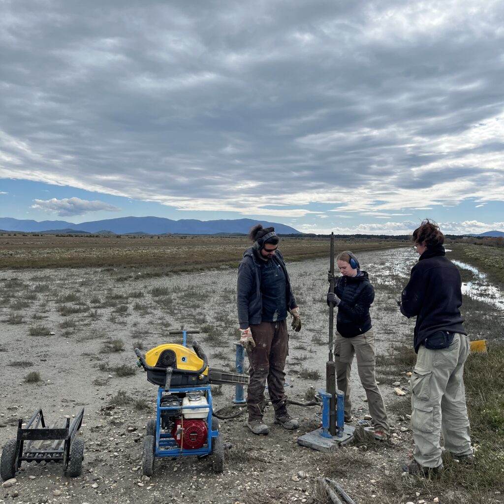
Field team collecting sediment cores from a coastal wetland in Albania to investigate sedimentary evidence of past tsunami events.
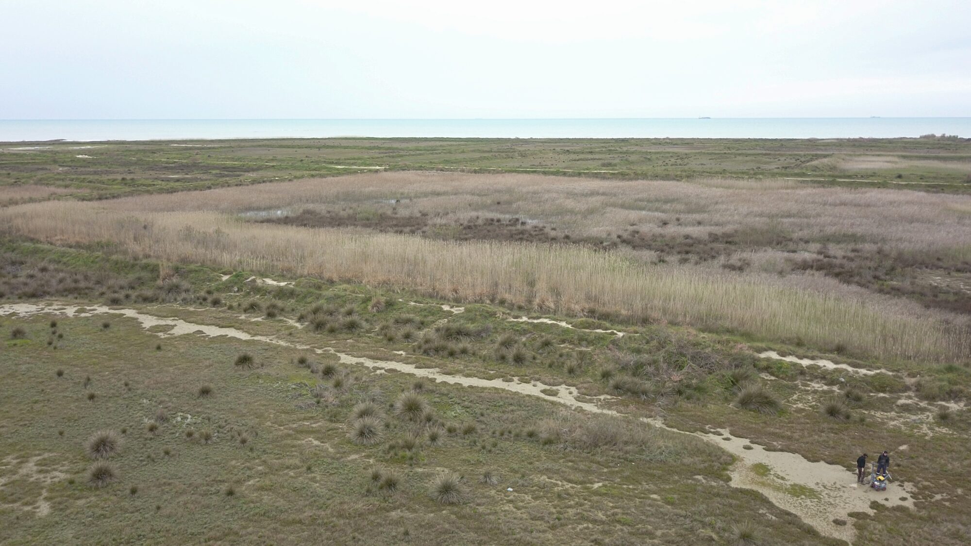
The Albanian coast lies at the active eastern margin of the Adriatic Plate, where the Adriatic microplate converges with Eurasia across the Dinarides-Hellenides/Albanides transition zone. This region is one of Europe’s most seismically active areas and has produced damaging earthquakes, including events near Shkodra, Durres and Montenegro. Earthquakes along the eastern Adriatic may generate tsunamis, but Albania remains a major data gap: historical reports are sparse and no sedimentary tsunami record has yet been documented. Coastal lowlands, river plains, lagoons and accreting coastal sectors may preserve sand layers or other traces of past tsunami inundation. Finding and dating such deposits would provide the first field-based evidence for past tsunamis along the Albanian Adriatic coast.
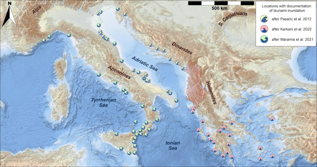
Overview map of paleotsunami studies around the Central and Eastern Mediterranean Sea including the Adriatic Sea. Locations of paleotsunami evidence are based on review articles by Pasarić et al. (2012); Maramai et al. (2021); Karkani et al. (2022). In transparent red highlighted it the proposed study area of Albania, where to date no tsunami studies have been conducted.
The project will carry out the first reconnaissance of sedimentary tsunami archives along the Albanian coast. It aims to identify possible tsunami deposits, establish first chronologies and recurrence intervals, and map their spatial distribution along selected coastal lowlands. Event layers will be compared with known earthquakes and tsunami evidence from neighboring regions, especially Greece and southern Italy, to test whether hazards cross the Adriatic. The resulting field-based data will help constrain tsunami sources, support regional paleoseismic interpretation, and improve tsunami hazard models for the eastern Adriatic margin.
– Identify promising coastal archives using maps, satellite imagery, historical coastline information and field reconnaissance.
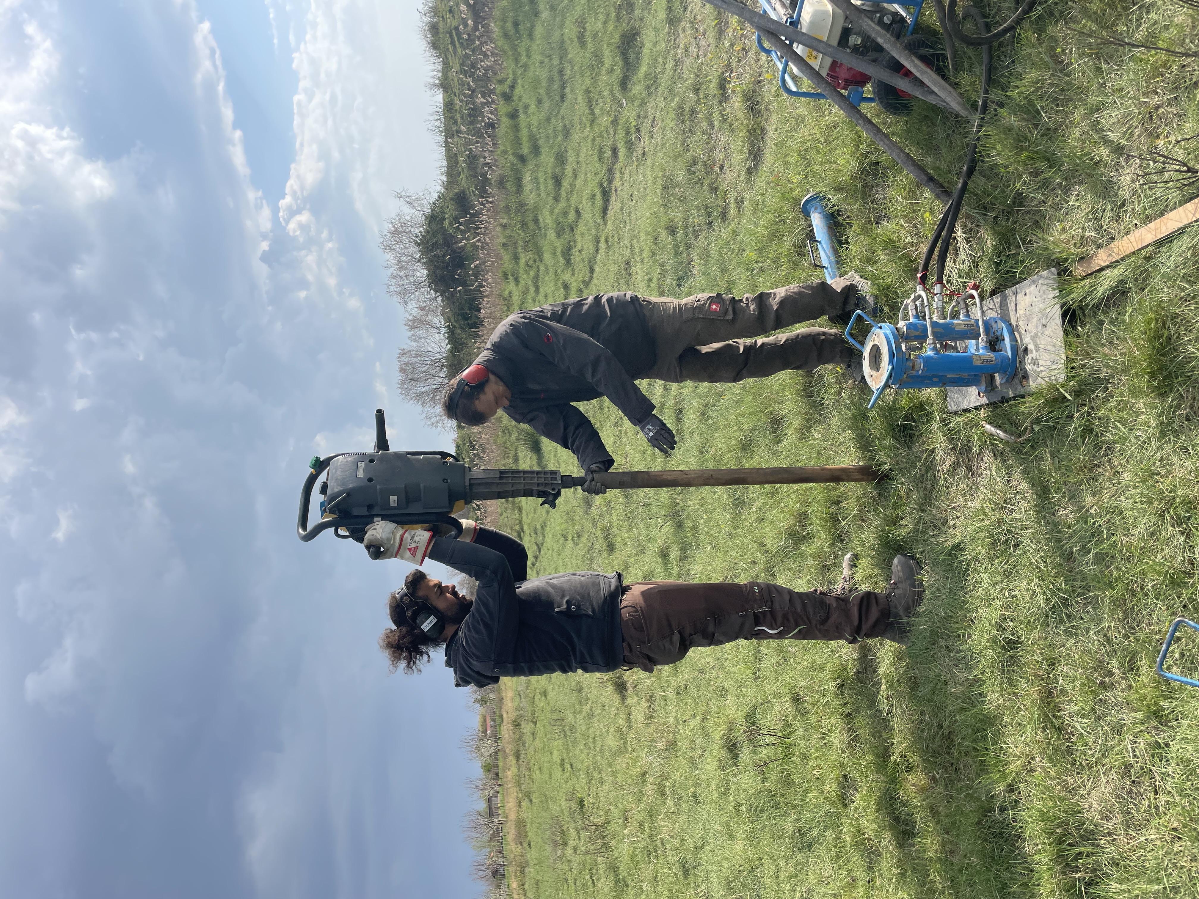
– Collect sediment cores along coast-perpendicular transects using open-window and closed-liner percussion coring.
– Use ground-penetrating radar and drone-based remote sensing to document site geometry and produce high-resolution digital elevation models.
– Describe, photograph and sample cores in the laboratory.
– Apply multi-proxy sediment analyses: grain size, XRF and micro-XRF geochemistry, total organic carbon and foraminiferal/microfossil analysis.
– Date event layers using radiocarbon and luminescence methods, combined in Bayesian age-depth models.
– Correlate candidate tsunami layers with regional earthquake and tsunami records.
Image: Field team collecting sediment cores from a coastal wetland in Albania to investigate sedimentary evidence of past tsunami events.
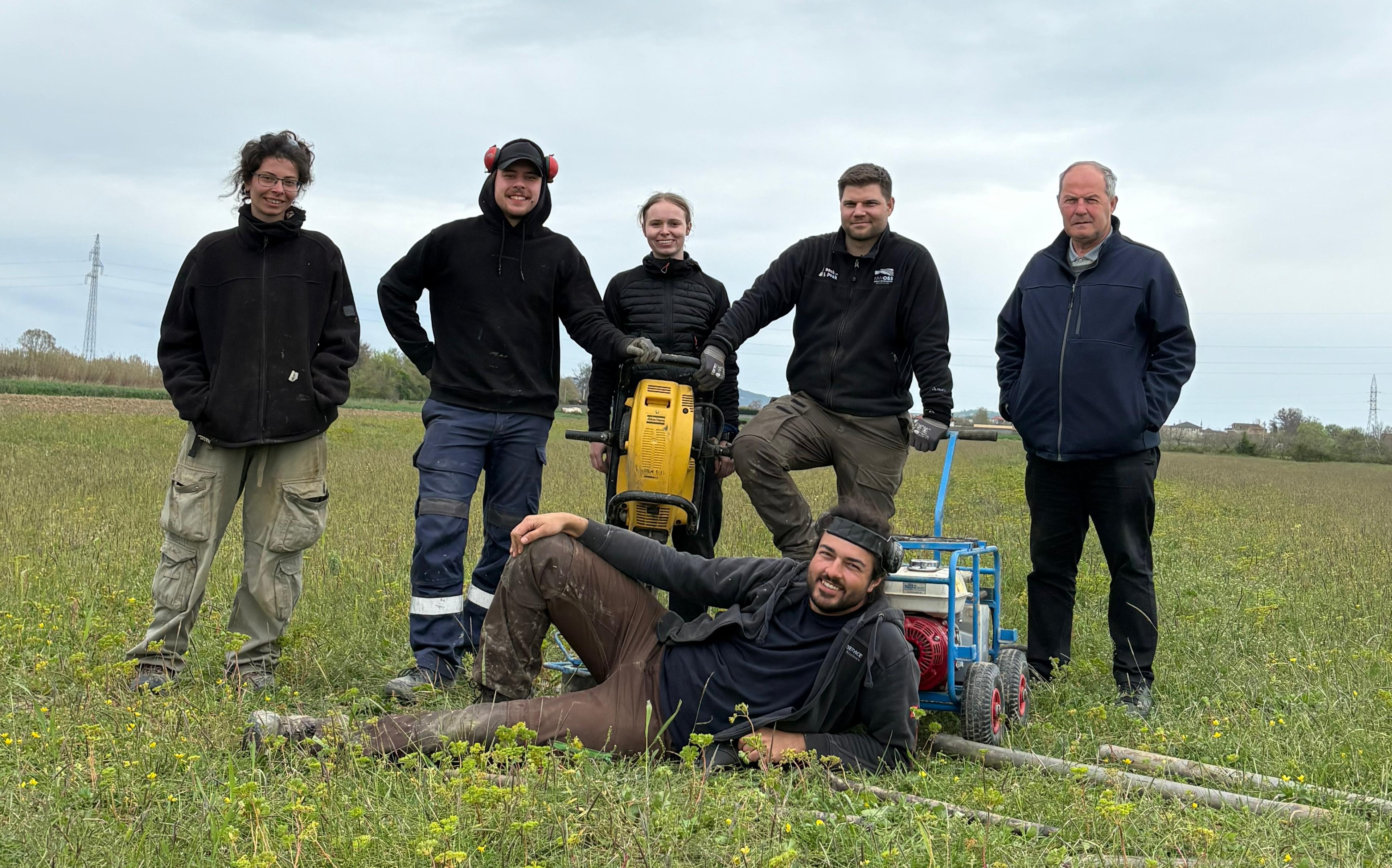
Group photo at the end of the first field campaign in April 2026. From left to right: Aliki Arianoutsou, Tobias Liberka, Madita Dinkelborg, Dr. Piero Bellanova, Prof. Dr. Kujtim Onuzi. Bottom: Richard Lohmiller
We use cookies to enhance your browsing experience and analyse our traffic. By clicking "Accept All", you consent to our use of cookies.
Functional
Always active
The technical storage or access is strictly necessary for the legitimate purpose of enabling the use of a specific service explicitly requested by the subscriber or user, or for the sole purpose of carrying out the transmission of a communication over an electronic communications network.
Preferences
The technical storage or access is necessary for the legitimate purpose of storing preferences that are not requested by the subscriber or user.
Statistics
The technical storage or access that is used exclusively for statistical purposes.The technical storage or access that is used exclusively for anonymous statistical purposes. Without a subpoena, voluntary compliance on the part of your Internet Service Provider, or additional records from a third party, information stored or retrieved for this purpose alone cannot usually be used to identify you.
Marketing
The technical storage or access is required to create user profiles to send advertising, or to track the user on a website or across several websites for similar marketing purposes.